Berichten over uw Buurt
Zoals vergunningen, bouwplannen en lokale regelgeving
Open data van de Overheid
Zoals vergunningen, bouwplannen en lokale regelgeving
Adressen en contactpersonen van overheidsorganisaties.
Dataset
| Status | Beschikbaar |
|---|---|
| Data eigenaar | Rijkswaterstaat (Rijk) |
| Bijgewerkt | 19-12-2025 |
| Licentie | CC-0 (1.0) |
| Thema |
|
| Toegang | Publiek |
| Metadata | Download (XML/RDF) |
In het bestand bodem.shp wordt de opbouw van de bovenste 80 cm van de waterbodem weergegeven. Het bestand schetst de bodemgesteldheid op het moment van kartering, 1981-1991. Bij het bestand horen drie layer of avl-bestanden waarin de legenda staat aangegeven. Deze bestanden kunnen ook gebruikt worden om de drie lagen die in het bestand verwerkt zitten te tonen, te weten 0-25, 25-50 en 50-80 cm. Toelichting over het bestand is aanwezig bij de afdeling WSM, dienst IJsselmeergebied.
Geen feedback gevonden.
Dit is een grafische representatie van de dataset die via het NationaalGeoregister.nl aangeboden wordt.
Het is mogelijk dat deze grafische representatie geen weerspiegeling van de data is, maar dient als ondersteunende afbeelding. Indien de dataset via een OGC:WMS service aangeboden wordt, is het mogelijk om zelf een grafische weergave van de dataset te genereren.
Bron: https://maps.rijkswaterstaat.nl/dataregister-publicatie/srv/api/records/bedbb737-2842-4f74-97f3-b9a1bf498962/attachments/small.jpg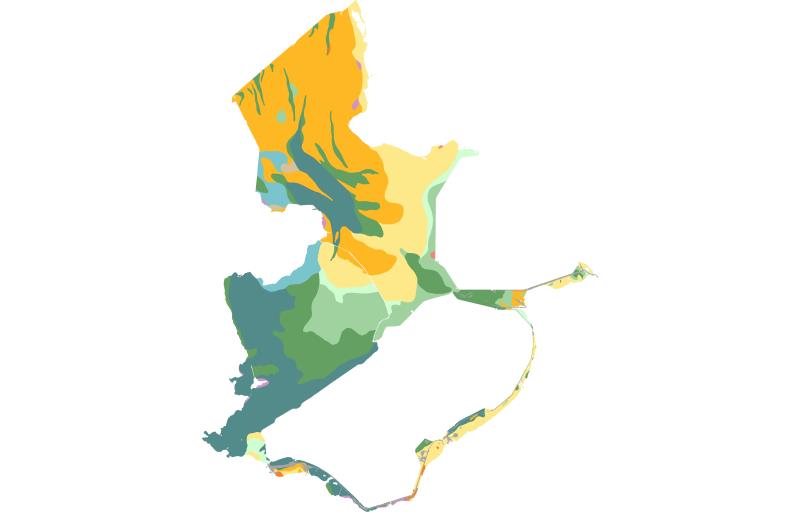
https://geo.rijkswaterstaat.nl/arcgis/rest/services/GDR/bodem_ijsselmeergebied/MapServer
accesPoint
https://geo.rijkswaterstaat.nl/arcgis/rest/services/GDR/bodem_ijsselmeergebied/FeatureServer
accesPoint
https://geo.rijkswaterstaat.nl/services/ogc/gdr/bodem_ijsselmeergebied/ows?service=WMS&request=getcapabilities&version=1.3.0
accesPoint
https://geo.rijkswaterstaat.nl/services/ogc/gdr/bodem_ijsselmeergebied/ows?service=WFS&request=getcapabilities&version=2.0.0
accesPoint
https://geo.rijkswaterstaat.nl/services/ogc/gdr/bodem_ijsselmeergebied/ows?service=WMS&request=getcapabilities&version=1.3.0
accesPoint
https://geo.rijkswaterstaat.nl/services/ogc/gdr/bodem_ijsselmeergebied/ows?service=WFS&request=getcapabilities&version=2.0.0
accesPoint
https://geo.rijkswaterstaat.nl/services/ogc/gdr/bodem_ijsselmeergebied/ows?service=WMS&request=getcapabilities&version=1.3.0
accesPoint
https://geo.rijkswaterstaat.nl/services/ogc/gdr/bodem_ijsselmeergebied/ows?service=WFS&request=getcapabilities&version=2.0.0
accesPoint
endPoint
endPoint
endPoint
endPoint
endPoint
endPoint
endPoint
endPoint
endPoint
endPoint
endPoint
endPoint
endPoint
endPoint
endPoint
endPoint
endPoint
endPoint
Geen feedback gevonden.