Berichten over uw Buurt
Zoals vergunningen, bouwplannen en lokale regelgeving
Open data van de Overheid
Zoals vergunningen, bouwplannen en lokale regelgeving
Adressen en contactpersonen van overheidsorganisaties.
Dataset
| Status | Beschikbaar |
|---|---|
| Data eigenaar | Rijkswaterstaat (Rijk) |
| Bijgewerkt | 19-06-2025 |
| Licentie | Onbekende licentie |
| Thema |
|
| Toegang | Beperkt |
| Metadata | Download (XML/RDF) |
U kunt bij ons een verzoek doen om een specifieke dataset aan te vragen.
Dataverzoek doenKaderrichtlijn Water stroomgebieddistricten Nederland (Maas, Schelde, Eems, Rijn) als vlakkenbestand. De stroomgebieddistricten worden gebruikt als rapportage eenheid voor de Kaderrichtlijn Water en voor de Richtlijn Overstromingsrisico.
Geen feedback gevonden.
U kunt bij ons een verzoek doen om een specifieke dataset aan te vragen.
Dataverzoek doenDit is een grafische representatie van de dataset die via het NationaalGeoregister.nl aangeboden wordt.
Het is mogelijk dat deze grafische representatie geen weerspiegeling van de data is, maar dient als ondersteunende afbeelding. Indien de dataset via een OGC:WMS service aangeboden wordt, is het mogelijk om zelf een grafische weergave van de dataset te genereren.
Bron: https://maps.rijkswaterstaat.nl/dataregister-publicatie/srv/api/records/f7bb2351-9788-42ea-a58b-a5ee1842304e/attachments/small.jpg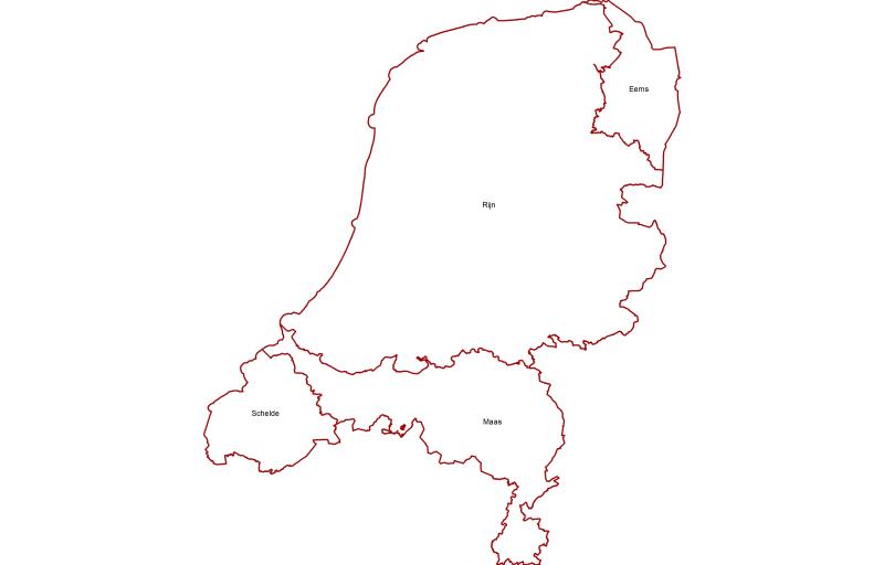
https://geo.rijkswaterstaat.nl/arcgis/rest/services/GDR/kaderrichtlijn_water/MapServer
ArcGIS MapService
https://geo.rijkswaterstaat.nl/arcgis/rest/services/GDR/kaderrichtlijn_water/FeatureServer
ArcGIS FeatureService
https://geo.rijkswaterstaat.nl/services/ogc/gdr/kaderrichtlijn_water/ows?service=WMS&request=getcapabilities&version=1.3.0
accessPoint
https://geo.rijkswaterstaat.nl/services/ogc/gdr/kaderrichtlijn_water/ows?service=WFS&request=getcapabilities&version=2.0.0
accessPoint
CSV
OGC:GML
JSON
OGC:KML
ZIP-SHAPE
GPKG
Geen feedback gevonden.