Berichten over uw Buurt
Zoals vergunningen, bouwplannen en lokale regelgeving
Open data of the government
Zoals vergunningen, bouwplannen en lokale regelgeving
Adressen en contactpersonen van overheidsorganisaties.
Dataset
| State | Available |
|---|---|
| Data owner | Rijkswaterstaat (Rijk) |
| Updated | 06/19/2025 - 00:00 |
| License | Onbekende licentie |
| Thema |
|
| Publicity level | Restricted |
| Metadata | Download (XML/RDF) |
You can do a datarequest to request a specific dataset.
Make a data requestOnderverdeling van de Kaderrichtlijn Water stroomgebieddistrict Rijn in 3 eenheden: Rijn-Noord, Rijn-West en Rijn-Oost. De eenheden, ook wel deelstroomgebieden genoemd, zijn een administratieve onderverdeling van de KRW stroomgebieddistricten. De eenheden zijn niet hetzelfde als de in de KRW genoemde 'Sub-Units'. Deze laatste zijn een meer hydrologische onderverdelingen van de KRW stroomgebieddistricten.
Landing page: https://github.com/codefornl/INSPIRE
No feedback found.
You can do a datarequest to request a specific dataset.
Make a data requestDit is een grafische representatie van de dataset die via het NationaalGeoregister.nl aangeboden wordt.
Het is mogelijk dat deze grafische representatie geen weerspiegeling van de data is, maar dient als ondersteunende afbeelding. Indien de dataset via een OGC:WMS service aangeboden wordt, is het mogelijk om zelf een grafische weergave van de dataset te genereren.
Source: https://maps.rijkswaterstaat.nl/dataregister-publicatie/srv/api/records/782cab20-8328-45f1-a9b2-c27d07c14066/attachments/small.jpg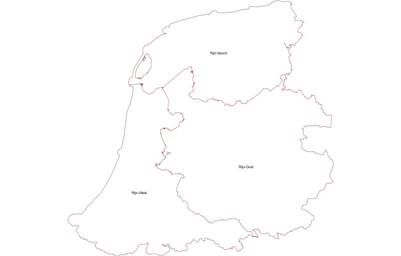
https://geo.rijkswaterstaat.nl/arcgis/rest/services/GDR/kaderrichtlijn_water/MapServer
ArcGIS MapService
https://geo.rijkswaterstaat.nl/arcgis/rest/services/GDR/kaderrichtlijn_water/FeatureServer
ArcGIS FeatureService
https://geo.rijkswaterstaat.nl/services/ogc/gdr/kaderrichtlijn_water/ows?service=WMS&request=getcapabilities&version=1.3.0
accessPoint
https://geo.rijkswaterstaat.nl/services/ogc/gdr/kaderrichtlijn_water/ows?service=WFS&request=getcapabilities&version=2.0.0
accessPoint
CSV
OGC:GML
JSON
OGC:KML
ZIP-SHAPE
GPKG
No feedback found.