Berichten over uw Buurt
Zoals vergunningen, bouwplannen en lokale regelgeving
Open data of the government
Zoals vergunningen, bouwplannen en lokale regelgeving
Adressen en contactpersonen van overheidsorganisaties.
Dataset
| State | Available |
|---|---|
| Data owner | Gelderland (Provincie) |
| Updated | 05/03/2025 - 00:00 |
| License | Publiek domein |
| Thema |
|
| Publicity level | Public |
| Metadata | Download (XML/RDF) |
You can do a datarequest to request a specific dataset.
Make a data request
De provincie beschermt de natte landnatuur door hydrologische beschermingszones aan te wijzen. Binnen deze gebieden streeft de provincie naar het op orde brengen en houden van de waterhuishoudkundige omstandigheden om zo de ecologische diversiteit van de natte landnatuur in het Gelders natuurnetwerk duurzaam in stand te houden. Dit bestand is vastgesteld door Provinciale Staten op 31 maart 2021, datum inwerkingtreding is 16 april 2021. Dit bestand is voor het laatst gewijzigd bij een beleidsarme wijziging dat vastgesteld is door gedeputeerde staten op 15 april 2025 en treedt in werking op 25 april 2025.
No feedback found.
You can do a datarequest to request a specific dataset.
Make a data requestDit is een grafische representatie van de dataset die via het NationaalGeoregister.nl aangeboden wordt.
Het is mogelijk dat deze grafische representatie geen weerspiegeling van de data is, maar dient als ondersteunende afbeelding. Indien de dataset via een OGC:WMS service aangeboden wordt, is het mogelijk om zelf een grafische weergave van de dataset te genereren.
Source: https://geodata.gelderland.nl/bestanden/geo-teksten/Metadata/bitmap/POVE_Beschzones_nat_landnat.png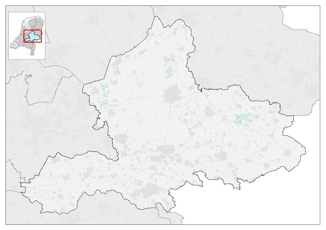
https://geoserver.gelderland.nl/geoserver/ngr_verordening/wms?service=WMS&request=GetCapabilities
accessPoint
https://geoserver.gelderland.nl/geoserver/ngr_verordening/wfs?service=WFS&request=GetCapabilities
accessPoint
accessPoint
No feedback found.