Berichten over uw Buurt
Zoals vergunningen, bouwplannen en lokale regelgeving
Open data of the government
Zoals vergunningen, bouwplannen en lokale regelgeving
Adressen en contactpersonen van overheidsorganisaties.
Dataset
| State | Available |
|---|---|
| Data owner | Rijkswaterstaat (Rijk) |
| Updated | 06/20/2025 - 00:00 |
| License | CC-0 (1.0) |
| Thema |
|
| Publicity level | Public |
| Metadata | Download (XML/RDF) |
You can do a datarequest to request a specific dataset.
Make a data requestHet Scheepvaart verkeersscheidingsstelsel Noodzee bevat kilometerpunten op de as van de vaargeulen op het Nederlands Continentaal Plat, Ankergebieden, vaargeulen, begrenzing en zonering. Deze dataset is aangemerkt als As-Is bron voor EU-doelen.
Landing page: https://www.rijkswaterstaat.nl/
No feedback found.
You can do a datarequest to request a specific dataset.
Make a data requestDit is een grafische representatie van de dataset die via het NationaalGeoregister.nl aangeboden wordt.
Het is mogelijk dat deze grafische representatie geen weerspiegeling van de data is, maar dient als ondersteunende afbeelding. Indien de dataset via een OGC:WMS service aangeboden wordt, is het mogelijk om zelf een grafische weergave van de dataset te genereren.
Source: https://downloads.rijkswaterstaatdata.nl/metadata_diversen/img/rws_vss.jpg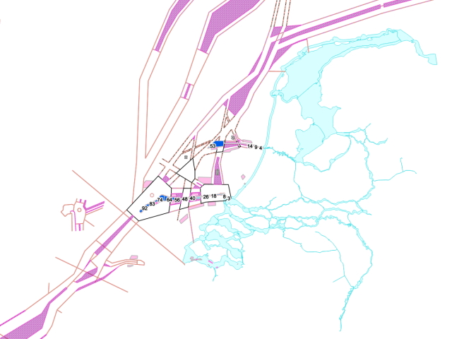
https://service.pdok.nl/rws/verkeersscheidingsstelsel/wms/v1_0?request=GetCapabilities&service=WMS&version=1.3.0
accessPoint
https://service.pdok.nl/rws/verkeersscheidingsstelsel/wms/v1_0?request=GetCapabilities&service=WMS&version=1.3.0
accessPoint
https://service.pdok.nl/rws/verkeersscheidingsstelsel/wms/v1_0?request=GetCapabilities&service=WMS&version=1.3.0
accessPoint
https://service.pdok.nl/rws/verkeersscheidingsstelsel/wms/v1_0?request=GetCapabilities&service=WMS&version=1.3.0
accessPoint
https://service.pdok.nl/rws/verkeersscheidingsstelsel/wms/v1_0?request=GetCapabilities&service=WMS&version=1.3.0
accessPoint
https://service.pdok.nl/rws/verkeersscheidingsstelsel/wfs/v1_0?request=GetCapabilities&service=WFS&version=1.1.0
accessPoint
https://service.pdok.nl/rws/verkeersscheidingsstelsel/wfs/v1_0?request=GetCapabilities&service=WFS&version=1.1.0
accessPoint
https://service.pdok.nl/rws/verkeersscheidingsstelsel/wfs/v1_0?request=GetCapabilities&service=WFS&version=1.1.0
accessPoint
https://service.pdok.nl/rws/verkeersscheidingsstelsel/wfs/v1_0?request=GetCapabilities&service=WFS&version=1.1.0
accessPoint
https://service.pdok.nl/rws/verkeersscheidingsstelsel/wfs/v1_0?request=GetCapabilities&service=WFS&version=1.1.0
accessPoint
https://service.pdok.nl/rws/verkeersscheidingsstelsel/atom/scheepvaart_verkeersscheidingsstelsel_noordzee_nederlands_continentaal_plat.xml
accessPoint
| name | type | description |
|---|---|---|
| name puntnummer | string | type |
| name entiteit_v | string | type |
| name entiteit_a | string | type |
| name entiteit_s | string | type |
| name entiteit_b | string | type |
| name entiteit_l | string | type |
| name opmerking | string | type |
| name groep | string | type |
| name geul | string | type |
| name x_etrs89 | double | type positie easting UTM coördinaat |
| name y_etrs89 | double | type positie northing UTM coördinaat |
| name vaargeul | string | type Naam van de vaargeul |
| name kilometer | string | type kilometering van de geul-as |
| name hoek_label | double | type Instelling voor visualisatie label |
| name eindcijfer | smallinteger | type Nummering voor visualisatie en bevraging |
| name kmvijf | smallinteger | type Instelling voor visualisatie label om de 5 km label |
| name kmtien | smallinteger | type Instelling voor visualisatie label om de 10 km label |
No feedback found.