Berichten over uw Buurt
Zoals vergunningen, bouwplannen en lokale regelgeving
Open data of the government
Zoals vergunningen, bouwplannen en lokale regelgeving
Adressen en contactpersonen van overheidsorganisaties.
Dataset
| State | Available |
|---|---|
| Data owner | Wageningen UR (Overig) |
| Updated | 03/14/2024 - 00:00 |
| License | Onbekende licentie |
| Thema |
|
| Publicity level | Restricted |
| Metadata | Download (XML/RDF) |
You can do a datarequest to request a specific dataset.
Make a data request
CORINE Land Cover change (2000-2006) database of the Netherlands An increasing need for factual and quantitative information on the state of the environment of DG Environment, DG Agriculture and other users initiated a proposal of the EEA to collaborate with the European Space Agency (ESA) and the European Commission (EC) on the implementation of a fast track service on land monitoring. The project focused on on timely, quality assured data, in particular in land cover and land use related issues for 2006-2008. The CLC2006 project is part of the GMES Fast Track Service Precursor (FTSP) Land Monitoring. In CLC2006 38 countries with total area of 5.8 Mkm2 are participating (32 EEA member states and 6 collaborating countries). 2. Thunnissen, H.A.M. and Middelaar, H.J. van, 1995. The CORINE Land Cover database of the Netherlands. Final report of the CORINE Land Cover project in the Netherlands. Report 78. Alterra, the Netherlands 3.EEA and ETC-TE, 2002. CORINE Land Cover update I&CLC2000 project. Technical Guidelines. Final Version. EEA, Denmark
Landing page: http://www.geodata.alterra.nl/portalen/datadocs/CLC2006_report_alterra_final.doc
No feedback found.
You can do a datarequest to request a specific dataset.
Make a data requestDit is een grafische representatie van de dataset die via het NationaalGeoregister.nl aangeboden wordt.
Het is mogelijk dat deze grafische representatie geen weerspiegeling van de data is, maar dient als ondersteunende afbeelding. Indien de dataset via een OGC:WMS service aangeboden wordt, is het mogelijk om zelf een grafische weergave van de dataset te genereren.
Source: https://www.nationaalgeoregister.nl/geonetwork/srv/api/records/7fdca464-e563-4a91-a46d-7d03ac15a9fc/attachments/clc_cha06_00.png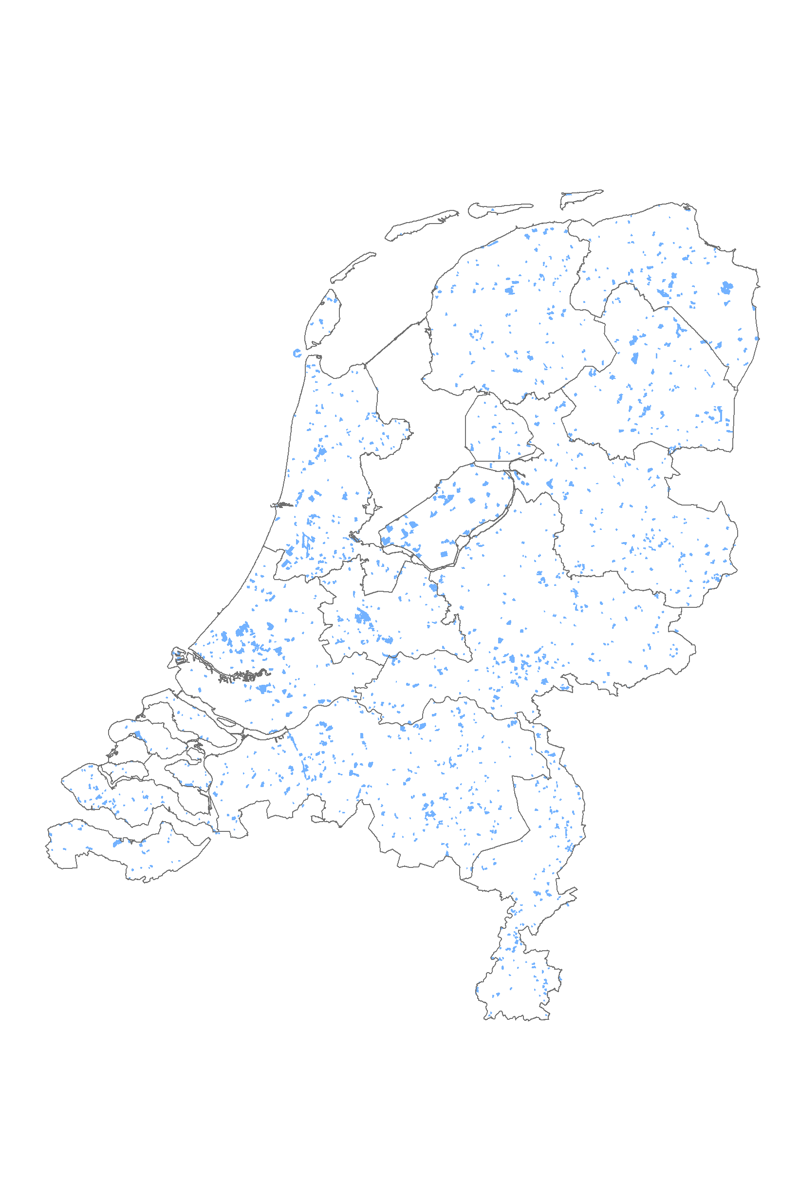
No feedback found.