Berichten over uw Buurt
Zoals vergunningen, bouwplannen en lokale regelgeving
Open data of the government
Zoals vergunningen, bouwplannen en lokale regelgeving
Adressen en contactpersonen van overheidsorganisaties.
Dataset
| State | Available |
|---|---|
| Data owner | Rijkswaterstaat (Rijk) |
| Updated | 06/20/2025 - 00:00 |
| License | CC-0 (1.0) |
| Thema |
|
| Publicity level | Public |
| Metadata | Download (XML/RDF) |
You can do a datarequest to request a specific dataset.
Make a data requestContour Nederlands deel van de Noordzee kust ten behoeve van productie Bathymetrie van de binnenwateren tot een 5 meter grid resolutie geinterpoleerd grid van waarden uit dieptemetingen van de hydrografische opnemingsvaartuigen opgeslagen in het Landelijk Opslagsysteem Lodingen. Deze dataset geeft een moment opname van de bodemligging van de binnenwateren Van de grens met Duitsland tot de basislijn van de Nederlandse kust en sluit aan bij Bathymetrie van de Noordzee.
Landing page: https://www.helpdeskwater.nl/onderwerpen/waterbodems/
No feedback found.
You can do a datarequest to request a specific dataset.
Make a data requestDit is een grafische representatie van de dataset die via het NationaalGeoregister.nl aangeboden wordt.
Het is mogelijk dat deze grafische representatie geen weerspiegeling van de data is, maar dient als ondersteunende afbeelding. Indien de dataset via een OGC:WMS service aangeboden wordt, is het mogelijk om zelf een grafische weergave van de dataset te genereren.
Source: https://maps.rijkswaterstaat.nl/dataregister-publicatie/srv/api/records/adn73c4a-ef03-4785-b7f6-942e86b385f7v/attachments/small.jpg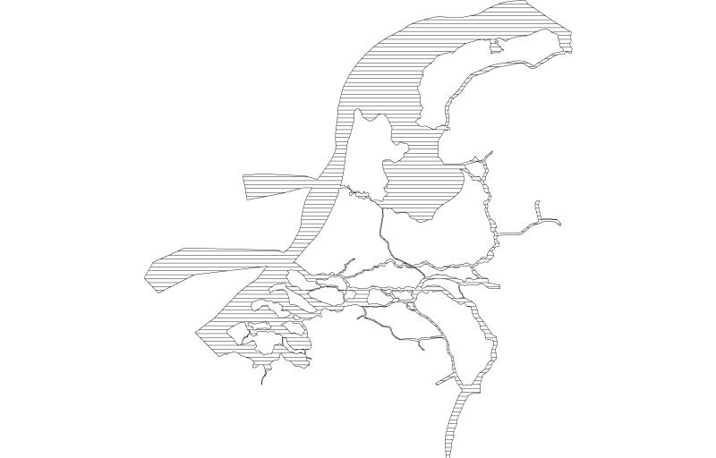
https://geo.rijkswaterstaat.nl/arcgis/rest/services/GDR/bodemhoogte_index/MapServer
ArcGIS MapService
https://geo.rijkswaterstaat.nl/arcgis/rest/services/GDR/bodemhoogte_index/FeatureServer
ArcGIS FeatureService
https://geo.rijkswaterstaat.nl/services/ogc/gdr/bodemhoogte_index/ows?service=WMS&request=getcapabilities&version=1.3.0
accessPoint
https://geo.rijkswaterstaat.nl/services/ogc/gdr/bodemhoogte_index/ows?service=WFS&request=getcapabilities&version=2.0.0
accessPoint
CSV
OGC:GML
JSON
gpkg
OGC:KML
ZIP-SHAPE
No feedback found.